Oneida County, New York
| Oneida County, New York | |
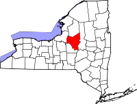 Location in the state of New York |
|
 New York's location in the U.S. |
|
| Founded | 1798 |
|---|---|
| Seat | Utica |
| Area - Total - Land - Water |
1,257 sq mi (3,256 km²) 1,213 sq mi (3,142 km²) 44 sq mi (114 km²), 3.53% |
| Population - (2000) - Density |
235,469 194/sq mi (75/km²) |
Oneida County is a county located in the U.S. state of New York. As of the 2000 census, the population was 235,469. The county seat is Utica. The name is in honor of the Oneida, an Iroquoian tribe that formerly occupied the region.
Oneida County is part of the Utica-Rome, NY Metropolitan Statistical Area.
Contents |
History
When counties were established in New York State in 1683, the present Oneida County was part of Albany County. This was an enormous county, including the northern part of New York State as well as all of the present state of Vermont and, in theory, extending westward to the Pacific Ocean. This county was reduced in size on July 3, 1766 by the creation of Cumberland County, and further on March 16, 1770 by the creation of Gloucester County, both containing territory now in Vermont.
On March 12, 1772, what was left of Albany County was split into three parts, one remaining under the name Albany County. One of the other pieces, Tryon County, contained the western portion (and thus, since no western boundary was specified, theoretically still extended west to the Pacific). The eastern boundary of Tryon County was approximately five miles west of the present city of Schenectady, and the county included the western part of the Adirondack Mountains and the area west of the West Branch of the Delaware River. The area then designated as Tryon County now includes 37 counties of New York State. The county was named for William Tryon, colonial governor of New York.
During and after the Revolution, most of the Loyalists in Tryon County fled to Canada. In 1784, following the peace treaty that ended the American Revolutionary War, the name of Tryon County was changed to Montgomery County to honor the general, Richard Montgomery, who had captured several places in Canada and died attempting to capture the city of Quebec, replacing the name of the hated British governor.
In 1789, the size of Montgomery County was reduced by the splitting off of Ontario County from Montgomery. The actual area split off from Montgomery County was much larger than the present county, also including the present Allegany, Cattaraugus, Chautauqua, Erie, Genesee, Livingston, Monroe, Niagara, Orleans, Steuben, Wyoming, Yates, and part of Schuyler and Wayne Counties.
In 1791, Herkimer County was one of three counties split off from Montgomery (the other two being Otsego, and Tioga County). This was much larger than the present county, however, and was reduced by a number of subsequent splits.
In 1794, Herkimer County was reduced in size by the splitting off of Onondaga County. This county was larger than the current Onondaga County, including the present Cayuga, Cortland, and part of Oswego Counties.
In 1798, Oneida County was created from a part of Herkimer County. This county was larger than the current Oneida County, including the present Jefferson, Lewis, and part of Oswego Counties.
In 1805, Jefferson and Lewis Counties were split off from Oneida.
In 1816, parts of Oneida and Onondaga Counties were taken to form the new Oswego County.
In 1848, John Humphrey Noyes founded a religious and Utopian community, the Oneida Community, near Oneida. Its unconventional views on religion and relations between the sexes led to much controversy. The community lasted until 1881.
Geography
Oneida County is in the central portion of New York State, east of Syracuse, and west of Albany. Oneida Lake is on the northwestern corner of the county, and the Adirondack Park is on the northeast. Part of the Tug Hill Plateau is in the northern part of the county. Interestingly, Oneida County's highest point does lies neither on the plateau nor in the Adirondack Park, but in the county's southern extremity. The peak's name is Tassel Hill. It is located slightly southeast of Hardscrabble Road (Tassel Hill Road), between the villages of Waterville and Cassville.
The Erie Canal bisects the county. Oneida Lake and Oneida Creek form part of the western boundary.
According to the U.S. Census Bureau, the county has a total area of 1,257 square miles (3,256 km²), of which 1,213 square miles (3,141 km²) is land and 44 square miles (115 km²) (3.53%) is water.
Adjacent counties
National protected area
- Fort Stanwix National Monument
Economy
Once, the main product of Oneida County was silverware, chiefly manufactured at Oneida Ltd.'s headquarters in Sherrill. In January 2005, the company ceased manufacturing their product, closing its main plant and selling its assets.
Currently the largest non-governmental, non-healthcare product of Oneida County is gambling. Turning Stone Casino Resort is an enterprise of the Oneida Indian Nation of New York, and the largest private employer in Oneida County. [1]
Demographics
| Historical populations | |||
|---|---|---|---|
| Census | Pop. | %± | |
| 1800 | 22,047 |
|
|
| 1810 | 33,792 | 53.3% | |
| 1820 | 50,997 | 50.9% | |
| 1830 | 71,326 | 39.9% | |
| 1840 | 85,310 | 19.6% | |
| 1850 | 99,566 | 16.7% | |
| 1860 | 105,202 | 5.7% | |
| 1870 | 110,008 | 4.6% | |
| 1880 | 115,475 | 5.0% | |
| 1890 | 122,922 | 6.4% | |
| 1900 | 132,800 | 8.0% | |
| 1910 | 154,157 | 16.1% | |
| 1920 | 182,833 | 18.6% | |
| 1930 | 198,763 | 8.7% | |
| 1940 | 203,636 | 2.5% | |
| 1950 | 222,855 | 9.4% | |
| 1960 | 264,401 | 18.6% | |
| 1970 | 273,037 | 3.3% | |
| 1980 | 253,466 | −7.2% | |
| 1990 | 250,836 | −1.0% | |
| 2000 | 235,469 | −6.1% | |
| Est. 2007[1] | 232,304 | −1.3% | |
| Source[2] | |||
As of the census[3] of 2000, there were 235,469 people, 90,496 households, and 59,184 families residing in the county. The population density was 194 people per square mile (75/km²). There were 102,803 housing units at an average density of 85 per square mile (33/km²). The racial makeup of the county was 90.21% White, 5.74% African American, 0.23% Native American, 1.16% Asian, 0.02% Pacific Islander, 1.11% from other races, and 1.52% from two or more races. Hispanic or Latino of any race were 3.20% of the population. 21.7% were of Italian, 13.1% Irish, 12.1% German, 9.9% Polish, 8.5% English and 5.6% American ancestry according to Census 2000. 90.6% spoke English, 2.7% Spanish, 1.3% Italian, 1.2% Serbo-Croatian and 1.1% Polish as their first language.
There were 90,496 households out of which 30.40% had children under the age of 18 living with them, 49.10% were married couples living together, 12.00% had a female householder with no husband present, and 34.60% were non-families. 29.50% of all households were made up of individuals and 13.10% had someone living alone who was 65 years of age or older. The average household size was 2.43 and the average family size was 3.02.
In the county the population was spread out with 23.90% under the age of 18, 8.60% from 18 to 24, 28.20% from 25 to 44, 22.90% from 45 to 64, and 16.50% who were 65 years of age or older. The median age was 38 years. For every 100 females there were 98.60 males. For every 100 females age 18 and over, there were 96.30 males.
The median income for a household in the county was $35,909, and the median income for a family was $45,341. Males had a median income of $32,194 versus $24,295 for females. The per capita income for the county was $18,516. About 9.80% of families and 13.00% of the population were below the poverty line, including 18.90% of those under age 18 and 8.50% of those age 65 or over.
Government and politics
Oneida County was governed by a board of supervisors until 1962, when the county charter was changed to create a county executive and a 29-seat county legislature. All 29 members of the legislature are elected from single member districts. The county executive is elected by the entire county.
| Name | Party | Term |
|---|---|---|
| Charles T. Lanigan | Republican | January 1, 1963 – December 31, 1966 |
| Harry S. Daniels | Republican | January 1, 1967 – December 31, 1967 (interim) January 1, 1968 – December 31, 1973 |
| William E. Bryant | Democrat | January 1, 1974 – April 21, 1979 |
| Antoinette Hyer | Democrat | April 22, 1979 – May 2, 1979 (acting) |
| Seymour Greene | Democrat | May 3, 1979 – June, 1979 (interim) |
| Michael Nasser | Democrat | June 1979 – December 31, 1979 (interim) |
| Sherwood L. Boehlert | Republican | January 1, 1980 – December 31, 1982 |
| John D. Plumley | Republican | January 1, 1983 – January 13, 1991 |
| Raymond A. Meier | Republican | January 14, 1991 – December 31, 1991 (interim) January 1, 1992 – December 31, 1996 |
| Ralph J. Eannace, Jr. | Republican | January 1, 1997 – May, 2003 |
| Joseph A. Griffo | Republican | May, 2003 – December 31, 2003 (interim) January 1, 2004 – December 31, 2006 |
| Anthony J. Picente, Jr. | Republican | January 1, 2007 – present |
Oneida County also leans republican in major statewide and national elections. In 2008 John McCain won the county by 6,000 votes out of 90,000 casted. He won all municipalities in the county except the city of Utica, and the town of Kirkland.
Cities, towns, and villages
- Annsville (town)
- Augusta (town)
- Ava (town)
- Barneveld (village)
- Boonville (town)
- Boonville (village)
- Bridgewater (town)
- Bridgewater (village)
- Camden (town)
- Camden (village)
- Clark Mills
- Clayville (village)
- Clinton (village)
- Deerfield (town)
- Florence (town)
- Floyd (town)
- Forestport (town)
- Holland Patent (village)
- Kirkland (town)
- Lee (town)
- Marcy (town)
- Marshall (town)
- New Hartford (village)
- New Hartford (town)
- New York Mills (village)
- Oneida Castle (village)
- Oriskany (village)
- Oriskany Falls (village)
- Paris (town)
- Prospect (village)
- Remsen (village)
- Remsen (town)
- Rome (city)
- Sangerfield (town)
- Sherrill (city)
- Steuben (town)
- Sylvan Beach (village)
- Trenton (town)
- Utica (city)
- Vernon (village)
- Vernon (town)
- Verona (town)
- Vienna (town)
- Waterville (village)
- Western (town)
- Westmoreland (town)
- Whitesboro (village)
- Whitestown (town)
- Yorkville (village)
- => designations in parentheses show official level of government.
County information
Educational institutes
- Mohawk Valley Community College
- Hamilton College
- Utica College of Syracuse University
- State University of New York Institute of Technology
Notable locations
- Steuben Memorial State Historic Site
- Oriskany Battlefield State Historic Site
- Fort Stanwix
- Griffiss Air Force Base
The Welsh
Oneida County in Central New York witnessed the development of one of the largest and certainly the most influential Welsh community in the United States. Suffering from poor harvests in 1789 and 1802 and dreaming of land ownership, the initial settlement of five Welsh families soon attracted other agricultural migrants, settling Stueben, Utica and Remsen townships. Adapting their traditional agricultural methods, the Welsh became the first to introduce dairying into the region and Welsh butter became a valued commodity on the New York market. Drawing on the size of the local ethnic community and the printing industry of Utica, Oneida County became the cultural center of Welsh-American life by 1830. The Welsh-American publishing industry included 19 different publishers who published 240 Welsh language imprints, 4 denominational periodicals and the influential newspaper Y Drych.
See also
- Oneida, New York, a city in Madison County
- Oneida Community, a former religious community
References
- ↑ Population Estimates as of July 1, 2007 by U.S. Census Bureau
- ↑ New York State Department of Economic Development
- ↑ "American FactFinder". United States Census Bureau. http://factfinder.census.gov. Retrieved 2008-01-31.
External links
- Oneida County, New York official site
- Oneida County Information
- Oneida County town histories
- Oneida County at the Open Directory Project
- Summary history of Oneida County
 |
Lewis County | |
||
| Oswego County | Herkimer County | |||
| Madison County | Otsego County |
|
|||||||||||||||||||||||
|
|||||||||||||||||